


Cultural heritage has a fundamental economic and social impact on the territory where it is located, and therefore its preservation is a priority for the entities that manage it. With this in mind, technological innovation can provide state-of-the-art tools for monitoring, protecting and preserving monuments and archaeological sites.
e-GEOS, at the forefront in the development of geo-information solutions to safeguard the planet and its heritage, has recently taken part, as a contractor of the holding company Leonardo, in the realisation of an integrated monitoring and emergency management system for the Archaeological Park of Sybaris, based on the use of Leonardo's data intelligence platform, specialised in environmental and cultural heritage monitoring, and capable of integrating and managing data from remote monitoring and sensor networks and on-site surveillance.
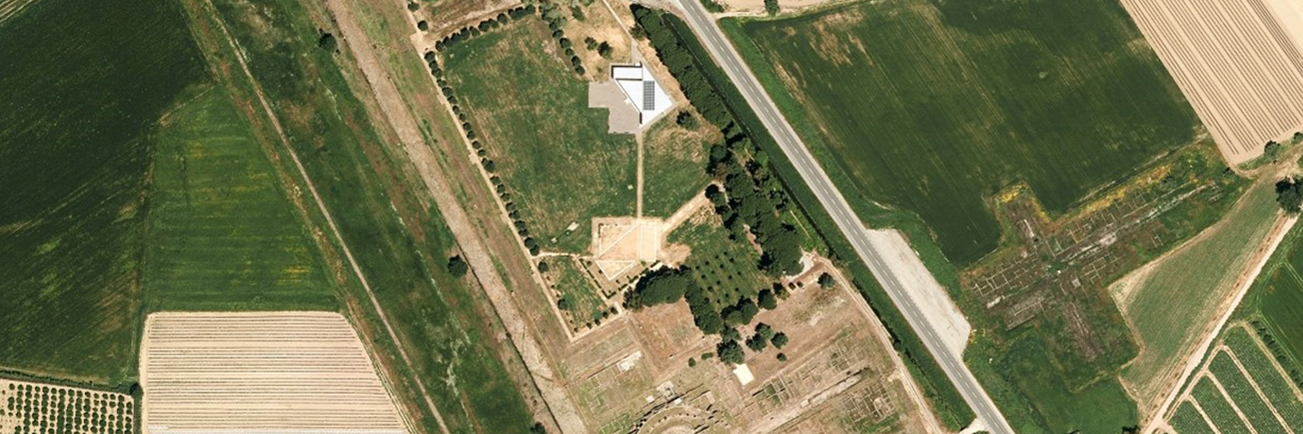
The area covered by the Park is extremely vulnerable from an environmental point of view, especially due to its exposure to the frequent flooding of the nearby river Crati.
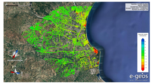
Within this scenario, e-GEOS set up two monitoring chains, dedicated respectively to the observation of ground instability risk and hydraulic risk: the first based on the INSAR methodology and the use of COSMO-SkyMed data, the second on weather data from the Air Force processed by an ad-hoc trained Artificial Intelligence model.
Interferometric monitoring is carried out offline at fixed time intervals, and the resulting ground displacement information is made available to users through the visualisation and query services of Leonardo's data intelligence platform. More in-depth and specialised data analysis can be conducted through e-GEOS's AWARE platform, which is accessible from the main system.
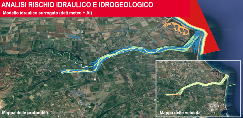
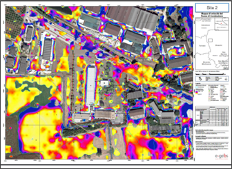
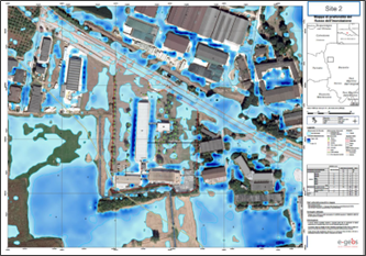
Hydraulic risk analysis, on the other hand, is carried out by modelling weather data on the area and automatically triggering the production of forecast risk maps whenever weather parameters reach threshold values considered to be at risk. As an output of this processing, maps of the speed and depth of flood waters are returned, describing the probable consequences of the evolving weather situation, thus enabling early damage control measures to be taken.
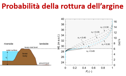
The employed methodology also allows the prediction of the risk of bank failure in the Crati river basin, with the identification of the most vulnerable areas.
On the International Day of Monuments and Sites, e-GEOS and Leonardo recommit themselves to provide their expertise and innovations in Earth Observation, to pass on the beauty of our cultural heritage.