


Our exploration of satellite technology and its use to reach UN Agenda 2030 Sustainable Development Goals (SDG) continues. This technology and SDG objectives are at the heart of the Leonardo 2030 Be Tomorrow Plan and the Leonardo Sustainability Plan.
Satellite observation is crucial to agriculture. Through international programmes, Leonardo plays a leading role manufacturing satellites with Thales Alenia Space, in data acquisition, services and applications with Telespazio and e-GEOS, and through the development of sensors – the "eyes" of the satellites – many of which are created in Leonardo's laboratories.

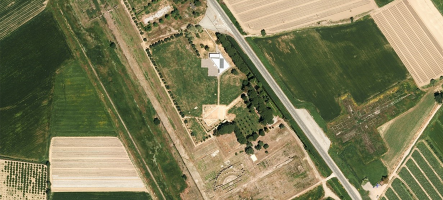
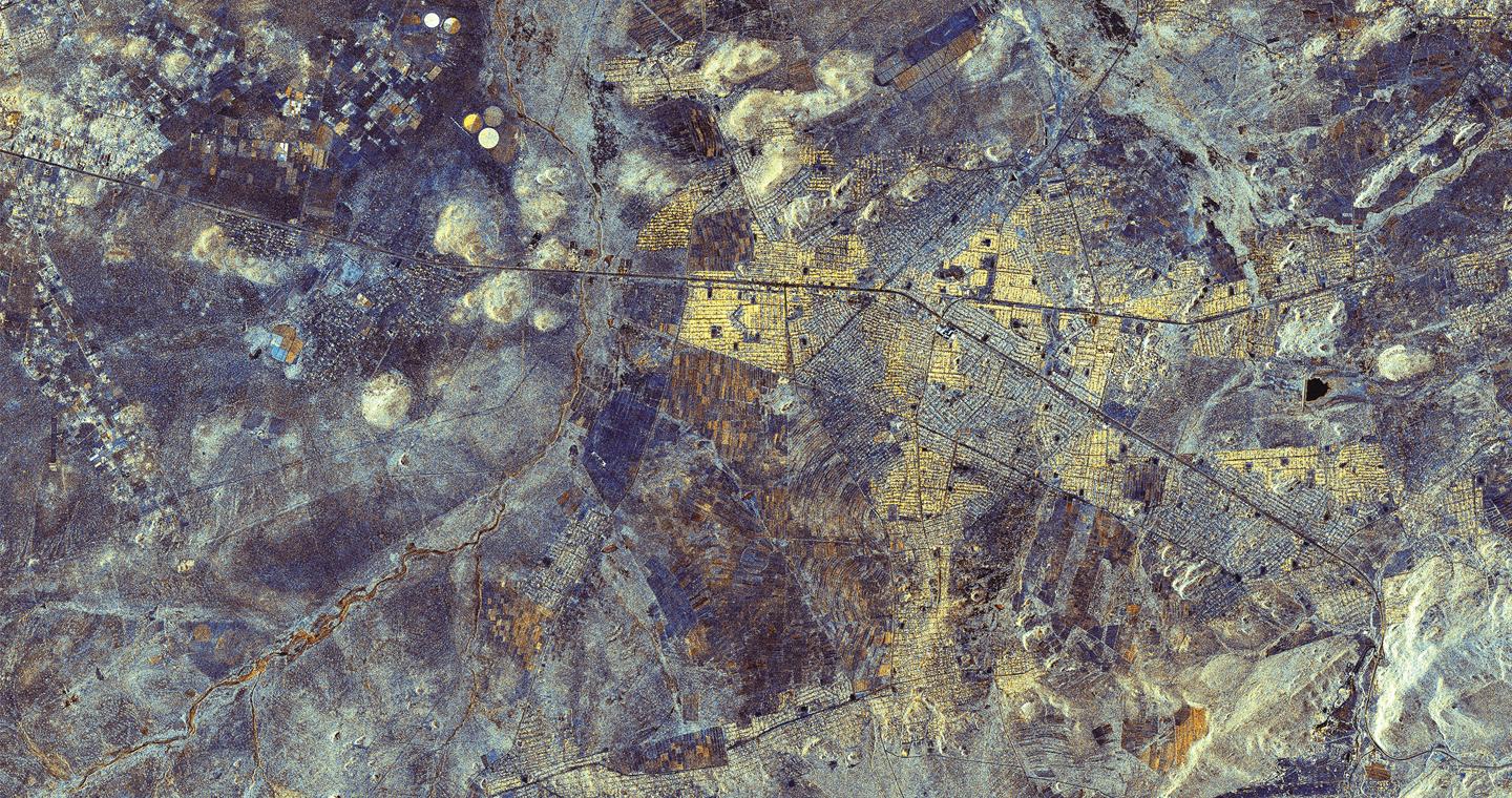
Limpopo, South Africa. Cosmo-SkyMed Second Generation Image © ASI (2020). Processed and distributed by e-GEOS
Love Planet Earth Calendar - photo associated with August 2021
This month, our journey takes us to South Africa, with a satellite image depicting agricultural plots in Limpopo. The corresponding National Geographic photo features a girl in a field in Hamakuya, right in the heart of Limpopo, who is concentrated on using a simple but efficient irrigation system for small-scale farming.
The photo is indicative of the farming that can benefit from the AgriGeo platform developed by e-GEOS. Its goal? To promote sustainable agriculture from macro to the micro farming.
To find out more, we spoke to Dino Quattrociocchi, Head of Product Management at e-GEOS.

Dino Quattrociocchi
How can satellites contribute to more sustainable agriculture?
Thanks to the wealth of data provided by the COSMO-SkyMed satellite constellation and other satellite missions, the AgriGeo platform - developed by e-GEOS - provides information to develop precision agriculture.
The term refers to a way of managing agriculture by measuring parameters related to water, soil fertility and use of pollutants, to facilitate the rational use of natural resources and to reduce costs thanks to optimised operations in the field and increased productivity.
The multi-sensor and multi-source approach allows users to understand the quality of soil by measuring its moisture level, as well as the level of water stress. This information enables targeted irrigation, optimising water usage and analysing the status and strength of a crop. In fact, the satellite makes it possible to identify areas that require chemical treatments, so they can be employed only where strictly necessary, with a positive impact on soil conservation and the quality of the water table.
Farmers, therefore, have detailed guidance on when and where which actions should be taken. This translates into lower costs, lower environmental impact and sustainability of the agricultural resource over time.
What makes e-GEOS services stand out and what advantages does it offer?
We possess data from different constellations and sources – satellites with radar and optical sensors, drones, in situ sensors and weather sensors – that generate value-added services. However, our users are not all necessarily experts in remote sensing, so we have to be able to provide information that is as simple, integrated, and direct as possible to make the data user-friendly and helpful in decision-making processes.
AgriGeo therefore acts as a link between the volume of data that we have and our users, extracting the best information and presenting it in an immediately accessible way. This is achieved using modern artificial intelligence-based data processing techniques developed and perfected by e-GEOS over the years. Another advantage of the platform is that it is available for any agricultural area in the world at any time of year.
In addition to precision agriculture, can the platform be used in other ways?
AgriGeo can be used in many different ways and by a variety of different users, such as large agricultural companies, insurance companies, agronomists and institutions including those under the European Union’s Common Agricultural Policy (CAP). The European Union is not a direct client of ours, but an indirect one through Italy’s Agricultural Payments Agency (AGEA), which distributes funds to agriculturalists based on amounts established by the CAP. To make objective measurements, satellites are used to verify that farmers’ claims are in line with rules established to apply subsidies.
Then there are insurance agencies; many agricultural companies insure their harvests against possible damage and atmospheric agents. In this example, to estimate the premium, insurance companies are able to use AgriGeo to perform a risk analysis based on information extracted from historic satellite data, going back 10-15 years.
Our services can also be used for defence and intelligence, to verify the agricultural production of any given country. Additionally, there are Fintech companies that need to establish the price of a product, such as an agricultural commodity. If e-GEOS can estimate the harvest of a crop such as wheat, for different countries, this information can be used to optimise the buying, selling and transportation of the crops, leveraging the estimate of the expected price based on what the satellite detects.
For more information on Earth observation technologies and solutions, you can also read other other interviews.
Discover the “Love Planet Earth 2021” Calendar