Financial highlights
Last trade 55.12€
Variation +2.61%
31/07/2026 - 05:35 PM
data source: Investis Digital
Financial Results & Reports
Press releases
Financial highlights
Last trade 55.12€
Variation +2.61%
31/07/2026 - 05:35 PM
data source: Investis Digital
Financial Results & Reports
Press releases
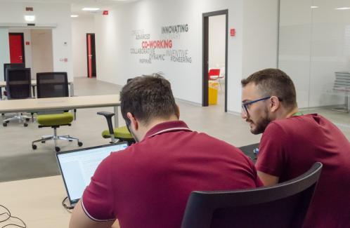
We spoke with Domenico Grandoni, Head of Big Data, Analytics & Artificial Intelligence Solutions Competence Centre at e-GEOS.
Satellite technology for both man and the planet, told through images from the 2021 Telespazio and e-GEOS “Love Planet Earth” calendar, created in collaboration with National Geographic Italia. This time we’re exploring the role that satellites can play in analysing air quality.
The impact of cities on the sustainable development of the planet is increasingly significant. Today, 54% of the world's population lives in cities, generating over 70% of carbon emissions and 78% of primary energy (source), while occupying only 3% of the Earth's surface. Analysis of satellite data plays a key role in monitoring this impact, providing an important contribution to Sustainable Development Goal 11 of the UN Agenda 2030: Sustainable Cities and Communities. Our exploration of sustainability continues in September through the images of the 2021 Telespazio and e-GEOS calendar Love Planet Earth featuring valuable imagery from National Geographic photographers.

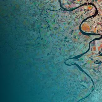
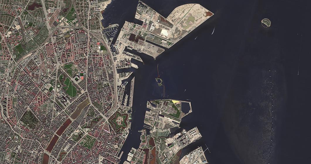
Copenhagen, Denmark. SuperView-1 Image © China Siwei Surveying and Mapping Technology (2020). Distributed by SpaceWill
Love Planet Earth Calendar – Shots associated with September 2021
This month's satellite image features Copenhagen's harbour, showing a long line of bicycles reflected in the water at Christians Brygge, the Danish capital's main waterfront, demonstrating widespread use of zero-emission vehicles. Air quality is one of the primary elements we can use to measure the quality of life in cities. This is another reason why it's important to monitor it, with space technology making an important impact in this task through international programmes. Leonardo plays a leading role in these through satellite manufacturing alongside Thales Alenia Space, in data acquisition, services and applications with Telespazio and e-GEOS, and through developing sensors – the "eyes" of the satellites – many of which are created in Leonardo's laboratories.
Creating space technologies to support sustainable growth on Earth is one of the pillars of Leonardo’s 2030 Be Tomorrow Plan and the company’s Sustainability Plan.
We spoke about it with Domenico Grandoni, Head of Big Data, Analytics & Artificial Intelligence Solutions Competence Centre at e-GEOS.

Domenico Grandoni
How can satellites monitor air quality?
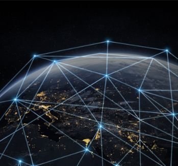
The advantage satellites offer is their ability to provide objective and consistent information through time and space. Today, there are satellites capable of observing specific variables we need to monitor air quality. The operational (Sentinel-5P, GHGSat) and planned (Sentinel CO2 mission) satellite missions are able to collect and process data on a global scale related to various atmospheric parameters and pollutants such as methane, carbon dioxide and particular pollutants. This is fundamental information needed to produce objective reporting and measure the effects of containment initiatives or the impact of new human activities. One interesting application has been the detection and analysis of concentration of particulate pollutants in the air (PM10) before, during and after the first lockdown. By analysing data from satellites, we can also create a map of pollutants in the air which provides reliable data on air quality over vast areas. In addition, it is possible to monitor and document any excesses of the legal concentration limits.
What makes satellites stand out and what advantages does it offer?
Satellites also provide us with large-scale homogeneous measurements, especially in areas of the Earth where satellites are the only available monitoring tools. Combined with drones and ground stations, satellites allow us to obtain data with a very high level of detail and accuracy. Satellites with increasingly high image resolution levels – developed primarily for defence and security – are proving to be fundamental to a wide variety of civil themes linked to sustainability. In recent years, we've observed an important change; there is new space in both the public and private sectors for satellite missions that can observe things like the concentration of CO2 in the air. This is important not only for large cities, where monitoring networks exist to measure air quality, but especially for areas where the detection of this information doesn't currently exist. Therefore, being able to calibrate and correlate what the satellite observes with what is detected on the ground gives us a very powerful measurement tool around the world.
How else can this satellite data be used?
The data is useful in the private and public spheres, including monitoring how greenhouse gas concentrations are linked to climate aspects for both governmental and commercial use. Services related to monitoring air pollutants can then be used for land-use planning, environmental reporting and identifying new sources of pollution or better understanding existing ones. Italy has invested heavily in the COSMO-SkyMed and PRISMA Earth Observation programmes and expects a high return on investment, not only in terms of jobs created, but also through the value generated by new services based on satellite data, covering a wide range of applications, from land monitoring to air quality analysis.
For more information on Earth observation technologies and solutions, you can also read other interviews.
Discover the Love Planet Earth 2021 Calendar